团队介绍
江苏师范大学AI遥感创新团队成立于2018年6月,专注于遥感信息的智能提取算法、软件和应用研究,旨在解决行业遥感应用中的自动化和高效率问题。团队成立以来,获批国家自然基金项目6项、省厅级项目12项,横向项目10项,累计获批经费1500余万元。发表论文80余篇。获得省部级科技进步奖与科研优秀成果奖7项,国家发明专利5项,软件著作权7项。培养12名硕士生考取博士。
团队负责人
张连蓬:江苏师范大学二级教授,测绘科学与技术学科带头人,AI遥感创新团队带头人,中国矿业大学博士生导师,山东科技大学博士,中科院遥感所博士后;江苏省“333高层次人才培养工程”中青年科学技术带头人,江苏省“青蓝工程”中青年学术带头人培养对象,徐州市测绘、遥感与地理信息系统工程技术研究中心主任;主持或参与国家863 项目、国家科技支撑计划项目、国家自然科学基金等项目多项,发表论文100 余篇。
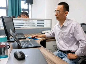
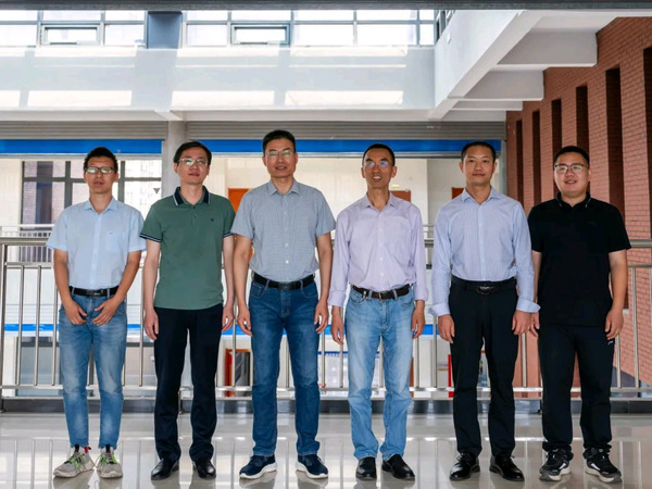
团队成员
李行:教授,硕导,华东师范大学博士,主要研究遥感信息提取,主持国家自然科学基金目2 项,其他省市级项目3项,发表学术论文40 余篇。
刘伟:副教授,硕导,中国矿业大学博士,南京大学博士后,主要研究深度学习与GIS开发,主持参与国家级项目10 余项,在国内外刊物发表论文30余篇,获得软件著作权11项。
李二珠:副教授,硕导,南京大学博士,主要研究深度学习、遥感图像分类,主持国家自然科学基金目2 项,发表学术论文30 余篇,担任10 余个国内、国际学术期刊审稿人。
刘文宋:副教授,硕导,武汉大学博士,主要从事微波遥感变化检测研究,主持国家自然科学基金目1项,发表学术论文20 余篇。
郭风城:副教授,硕导,武汉大学博士,主要从事微波遥感目标提取算法研究,主持国家自然科学基金目1 项,发表学术论文20 余篇。
团队主要研究成果
1) 团队主要论文
序号 | 论文题目 | 发表时间 | 发表刊物 | 论文类别 | 第一/通讯 |
1 | Land Cover Change Detection Based on Vector Polygons and Deep Learning With High Resolution Remote Sensing Images | 202401 | IEEE Transactions on Geoscience and Remote Sensing | 自然科学 A3、SCI一区TOP | 刘伟 |
2 | A Building Shape Vectorization Hierarchy From VHR Remote Sensing Imagery Combined DCNNs-Based Edge Detection and PCA-Based Corner Extraction | 202301 | IEEE Journal of Selected Topics in Applied Earth Observations and Remote Sensing | 自然科学A4、SCI二区TOP | 张连蓬 |
3 | Pixel Difference Function and Local Entropy-Based Speckle Reducing Anisotropic Diffusion | 202206 | IEEE Transactions on Geoscience and Remote Sensing | 自然科学 A3、SCI一区TOP | 郭风成 |
4 | A Dual-domain Super-resolution Image Fusion Method with SIRV and GALCA Model for PolSAR and Panchromatic Images | 202112 | IEEE Transactions on Geoscience and Remote Sensing | 自然科学 A3、SCI一区TOP | 刘文宋 |
5 | Fusion Despeckling Based on Surface Variation Anisotropic Diffusion Filter and Ratio Image Filter | 202004 | IEEE Transactions on Geoscience and Remote Sensing | 自然科学 A3、SCI一区TOP | 郭风成 |
6 | Spatiotemporal patterns of recent PM2.5 concentrations over typical urban agglomerations in China | 201902 | Science of the Total Environment | 自然科学 A3、SCI一区TOP | 张连蓬 |
7 | LFEMAP-Net: Low-Level Feature Enhancement and Multiscale Attention Pyramid Aggregation Network for Building Extraction From High-Resolution Remote Sensing Images | 202401 | IEEE Journal of Selected Topics in Applied Earth Observations and Remote Sensing | 自然科学A4、SCI二区TOP | 李二珠 |
8 | Integrated Quantitative Evaluation Method of SAR Filter | 202303 | Remote Sensing | 自然科学A4、SCI二区TOP | 郭风成 |
9 | Non-Local Means De-speckling Based on Multi-Directional Local Plane Inclination Angle | 202302 | Remote Sensing | 自然科学A4、SCI二区TOP | 郭风成 |
10 | An Object-Oriented CNN Model Based on Improved Superpixel Segmentation for High-Resolution Remote Sensing Image Classification | 202209 | IEEE Journal of Selected Topics in Applied Earth Observations and Remote Sensing | 自然科学A4、SCI二区TOP | 李二珠 |
11 | Estimating Large-Scale Interannual Dynamic Impervious Surface Percentages Based on Regional Divisions | 202208 | Remote Sensing | 自然科学A4、SCI二区TOP | 李二珠 |
12 | ME-Net: A Multi-Scale Erosion Network for Crisp Building Edge Detection from Very High Resolution Remote Sensing Imagery | 202109 | Remote Sensing | 自然科学 A4、SCI 二区TOP | 张连蓬 |
13 | Building Outline Extraction Directly Using the U2-Net Semantic Segmentation Model from High-Resolution Aerial Images and a Comparison Study | 202108 | Remote Sensing | 自然科学 A4、SCI 二区TOP | 李行 |
14 | Estimating Artificial Impervious Surface Percentage in Asia by Fusing Multi-Temporal MODIS and VIIRS Nighttime Light Data | 202101 | Remote Sensing | 自然科学 A4、SCI 二区TOP | 李二珠 |
15 | Building Footprint Extraction from Unmanned Aerial Vehicle Images Via PRU-Net: Application to Change Detection | 202101 | IEEE Journal of Selected Topics in Applied Earth Observations and Remote Sensing | 自然科学 A4、SCI 二区TOP | 刘伟 |
16 | Recent evolution of the Irrawaddy (Ayeyarwady) Delta and the impacts of anthropogenic activities: A review and remote sensing survey | 202009 | Geomorphology | 自然科学 A4、SCI二区 | 李行 |
17 | Mapping 10-m Resolution Rural Settlements Using Multi-Source Remote Sensing Datasets with the Google Earth Engine Platform | 202009 | Remote Sensing | 自然科学 A4、SCI 二区TOP | 李行 |
18 | High-Resolution Imagery Classification Based on Different Levels of Information | 201912 | Remote Sensing | 自然科学 A4、SCI 二区TOP | 李二珠 |
19 | Accurate Building Extraction from Fused DSM and UAV Images Using a Chain Fully Convolutional Neural Network | 201912 | Remote Sensing | 自然科学 A4、SCI 二区TOP | 刘伟 |
20 | Speckle Reduction by Directional Coherent Anisotropic Diffusion | 201911 | Remote Sensing | 自然科学 A4、SCI 二区TOP | 郭风成 |
21 | Speckle Suppression by Weighted Euclidean Distance Anisotropic Diffusion | 201805 | Remote Sensing | 自然科学 A4、SCI 二区TOP | 郭风成 |
22 | Mapping national-scale aquaculture ponds based on the Google Earth Engine in the Chinese coastal zone | 202004 | Aquaculture | SCI一区TOP | 李行 |
23 | Remote Sensing Scene Classification Based on Multibranch Fusion Attention Network | 202307 | IEEE Geoscience and Remote Sensing Letters | SCI二区 | 刘伟 |
24 | Feature Alignment FPN for Oriented Object Detection in Remote Sensing Images | 202301 | IEEE Geoscience and Remote Sensing Letters | SCI 二区 | 李二珠 |
25 | Analysis and evaluation of surface water changes in the lower reaches of the Yangtze River using Sentinel-1 imagery | 202204 | Journal of Hydrology: Regional Studies | SCI二区 | 刘文宋 |
26 | First and Second-Order Information Fusion Networks for Remote Sensing Scene Classification | 202106 | IEEE Geoscience and Remote Sensing Letters | SCI 二区 | 李二珠 |
27 | Improved Bilinear CNN Model for Remote Sensing Scene Classification | 202007 | IEEE Geoscience and Remote Sensing Letters | SCI 二区 | 李二珠 |
28 | Extraction and spatiotemporal changes of open-pit mines during 1985–2020 using Google Earth Engine: A case study of Qingzhou City, Shandong Province, China | 202212 | Environmental Monitoring and Assessment | SCI三区 | 李行 |
29 | Understanding Land use/Land cover dynamics and impacts of human activities in the Mekong Delta over the last 40 years | 202006 | Global Ecology and Conservation | SCI三区 | 李行 |
30 | Detecting spatiotemporal changes of large-scale aquaculture ponds regions over 1988–2018 in Jiangsu Province, China using Google Earth Engine | 202004 | Ocean & Coastal Management | SCI三区 | 李行 |
31 | Rapid Loss of Tidal Flats in the Yangtze River Delta since 1974 | 202003 | International Journal of Environmental Research and Public Health | SCI三区 | 李行 |
32 | Small Manhole Cover Detection in Remote Sensing Imagery with Deep Convolutional Neural Networks | 201901 | ISPRS International Journal of Geo-Information | SCI三区 | 刘伟 |
33 | Long-Term Analysis of Aerosol Optical Depth over the Huaihai Economic Region (HER): Possible Causes and Implications | 201809 | Atmosphere | SCI三区 | 张连蓬 |
34 | A Few-Shot Semi-Supervised Learning Method for Remote Sensing Image Scene Classification | 202402 | Photogrammetric Engineering & Remote Sensing | SCI 四区 | 李二珠 |
35 | Superpixel segmentation of high-resolution remote sensing image based on feature reconstruction method by salient edges | 202304 | Journal of Applied Remote Sensing | SCI 四区 | 李二珠 |
36 | Insights into spatiotemporal variations of the water quality in Taihu Lake Basin, China | 202110 | Environmental Monitoring and Assessment | SCI四区 | 张连蓬 |
37 | Object-Based Mapping of Plastic Greenhouses with Scattered Distribution in Complex Land Cover Using Landsat 8 OLI Images: A Case Study in Xuzhou, China | 202002 | Journal of the Indian Society of Remote Sensing | SCI四区 | 张连蓬 |
38 | 基于改进HLT与深度学习的双时相PolSAR洪涝灾害监测新方法 | 202308 | 地球信息科学学报 | EI | 刘文宋 |
39 | 基于高分二号遥感影像的露天灰岩矿区裸岩提取方法 | 202207 | 地球科学 | EI | 李行 |
40 | 融合多源时序遥感数据大尺度不透水面覆盖率估算 | 202010 | 遥感学报 | EI | 李二珠 |
41 | Soil Property Surface Modeling Based on Ensemble Learning for Complex Landforms | 201902 | Geo-informatics in Sustainable Ecosystem and Society (GSES) | EI | 刘伟 |
42 | 融合多方向Sobel 算子的相干斑各向异性扩散抑制 | 202310 | 遥感技术与应用 | 中文核心 | 郭风成 |
43 | 顾及PolSAR 影像极化-空间信息的农作物识别方法 | 202305 | 测绘科学 | 中文核心 | 刘文宋 |
44 | 顾及 GF-3 影像纹理特征的洪涝范围提取方法 | 202205 | 测绘通报 | 中文核心 | 刘文宋 |
45 | A Novel Unsupervised Change Detection Method with Structure Consistency and GFLICM Based on UAV Images | 202201 | 测绘学报(英文版) | CSCD | 刘文宋 |
46 | 基于PRCUnet的高分遥感影像建筑物提取 | 202110 | 地球信息科学学报 | 中文核心 | 刘伟 |
47 | 卫星+AI时代遥感专业模式识别课程的教学实践与改革 | 202102 | 测绘通报 | 中文核心 | 李二珠 |
48 | 深度学习和遥感影像支持的矢量图斑地类解译真实性检查方法 | 202010 | 地球信息科学学报 | 中文核心 | 刘伟 |
49 | 深度卷积神经网络支持下的遥感影像语义分割 | 202005 | 测绘通报 | 中文核心 | 刘伟 |
50 | 深度卷积网络支持下的遥感影像井盖部件检测 | 201908 | 测绘通报 | 中文核心 | 刘伟 |
51 | 长江三角洲滩涂信息的遥感提取及时空变化 | 201902 | 地球信息科学学报 | 中文核心 | 李行 |
52 | 集成学习支持的复杂地貌类型区土壤全钾含量自适应曲面建模 | 201902 | 测绘通报 | 中文核心 | 刘伟 |
53 | 徐州市气溶胶光学厚度与PM2.5相关性及年周期特征 | 201901 | 地球与环境 | 中文核心 | 张连蓬 |
2) 团队主要科研项目
序号 | 项目名称 | 下达项目部门或单位 | 立项年份 | 获得项目经费(万元) | 项目负责人/名次 |
1 | 域适应驱动的自然资源专题要素类别和边界可靠性核查方法研究 | 国家自然科学基金项目 | 2024 | 54 | 刘伟/1 |
2 | 跨传感器域适应学习的遥感影像场景分类研究 | 国家自然科学基金项目 | 2023 | 46 | 李二珠/1 |
3 | 基于格局-过程耦合体系的区域滩涂演变机制研究——以长江口为例 | 国家自然科学基金项目 | 2022 | 52 | 李行/1 |
4 | 面向多模式时序PolSAR结构一致性的时空自适应变化检测研究 | 国家自然科学基金项目 | 2022 | 30 | 刘文宋/1 |
5 | 基于中智理论与自适应偏微分方程的SAR相干斑抑制研究 | 国家自然科学基金项目 | 2021 | 30 | 郭风成/1 |
6 | 顾及先验地理信息的城市空间结构类型深度特征表达及识 | 国家自然科学基金项目 | 2018 | 25 | 李二珠/1 |
7 | 顾及空谱一致性域适应学习的多源遥感图像分类研究 | 江苏省科技厅 | 2023 | 10 | 李二珠/1 |
8 | 基于SAR高质量抑斑影像的震害建筑物提取研究 | 江苏省科技厅 | 2021 | 20 | 郭风成/1 |
9 | 基于时序PolSAR影像的自然灾害变化检测关键算法研究 | 江苏省科技厅 | 2020 | 20 | 刘文宋/1 |
10 | 自然资源部国土卫星遥感应用重点实验室开放基金 | 自然资源部 | 2022 | 20 | 刘伟/1 |
11 | 基于开集域适应学习的遥感影像场景分类方法研究 | 江苏省高校自然科学基金 | 2023 | 3 | 李二珠/1 |
12 | 面向遥感大模型的超大规模样本库自动构建关键技术研究及应用示范 | 徐州市科技局 | 2024 | 150 | 刘伟/2 |
13 | 自然资源高分遥感影像解译及其耕地“双非”监测技术 | 徐州市科技局 | 2023 | 150 | 张连蓬/1 |
14 | 面向时序PolSAR影像的森林火灾动态监测研究 | 徐州市科技局 | 2023 | 10 | 刘文宋/1 |
15 | 骆马湖饮用水源地环境常态化遥感监测关键技术研究 | 徐州市科技局 | 2020 | 10 | 刘伟/1 |
16 | 深度学习支持的“三调”地类智能解译关键技术研究与应用 | 徐州市科技局 | 2018 | 10 | 张连蓬/1 |
3) 团队科研奖励
序号 | 获奖名称 | 获奖时间 | 获奖等级 | 授奖部门 | 团队主要获奖成员 |
1 | 江苏省土地学会科技进步奖 | 202312 | 三等奖 | 江苏省土地学会 | 刘伟 |
2 | 地理信息科技进步奖 | 202310 | 二等奖 | 中国地理信息产业协会 | 李二珠 |
3 | 教育部高等学校科学研究优秀成果奖 | 202206 | 二等奖 | 教育部 | 李二珠 |
4 | 河南省科学技术进步奖 | 202106 | 二等奖 | 河南省政府 | 刘伟 |
5 | 测绘科技进步奖 | 201910 | 一等奖 | 中国测绘学会 | 李二珠 |
6 | 测绘科技进步奖 | 201910 | 一等奖 | 中国测绘学会 | 郭风成 |
7 | 江苏省测绘地理信息科技进步奖 | 201811 | 一等奖 | 江苏省测绘地理信息学会 | 李二珠 |
4) 团队专利
序号 | 成果名称 | 主要完成人 | 类别 |
1 | 一种扫描纸质海图水深点自动矢量化及信息提取方法 | 李行 | 国家发明专利 |
2 | 一种扫描纸质海图水深点自动矢量化及信息提取的改进方法 | 李行 | 国家发明专利 |
3 | 土地利用/覆被要素多特征变化转移矩阵矢量化提取方法 | 王育红、张连蓬 | 国家发明专利 |
4 | 一种基于时间序列PolSAR影像的土地覆盖类型变化检测方法 | 刘文宋 | 国家发明专利 |
5 | 一种基于深度学习的遥感影像建筑物提取及轮廓优化方法 | 刘伟 | 国家发明专利 |
5) 团队软件著作权
序号 | 成果名称 | 主要完成人 | 类别 |
1 | 深度学习支持的“三调”矢量图斑分析判别系统 | 刘伟、张连蓬 | 软件著作权 |
2 | 土壤调查数据模拟分析系统 | 刘伟、张连蓬 | 软件著作权 |
3 | 城市碳核查综合管理与应用系统 | 刘伟、张连蓬 | 软件著作权 |
4 | 资源环境承载力评价辅助分析系统 | 刘伟 | 软件著作权 |
5 | 青海湖流域生态环境信息集成平台 | 刘伟、张连蓬 | 软件著作权 |
6 | 能源矿产资源综合评价与区划GIS辅助分析系统 | 刘伟 | 软件著作权 |
7 | 基于PIE软件的PolSAR影像解译系统 | 刘文宋 | 软件著作权 |